

Even the most detailed set of construction drawings is only useful if the project gets built in the right place. Construction layout is the process that makes this possible, transferring dimensions, elevations, and reference points from approved plans onto the physical job site before any digging or building begins.
This guide covers what construction layout involves, who performs it, which tools are used in the field, and what goes wrong when it is handled poorly. Whether you are a property owner planning a new build, a general contractor managing a commercial project, or a field crew member stepping into a layout role for the first time, understanding how this process works helps every stage of construction that follows run more smoothly.
What is construction layout
Construction layout is the process of transferring the measurements, dimensions, and reference points from architectural and engineering drawings onto the physical job site. It is the technical link between a finished set of plans and the actual ground where construction takes place. Before a single foundation wall is poured or a structural column rises out of the slab, crews must know precisely where each element belongs in three-dimensional space, and layout is what answers that question.
Layout in construction connects two stages of a project: the finished, approved design and the physical site where that design has to be built. A building layout plan typically marks the corners of a structure, the centerlines of interior walls, the locations of columns, and the elevations crews need to follow for grading, foundations, and finished floors. Once these reference points are set, excavation, concrete placement, framing, and every trade that follows can proceed with confidence that the structure will land where the design intended.

Why accurate construction layout matters
Accurate layout determines whether a project stays on schedule and within budget. Once concrete is poured or framing goes up, correcting a layout error usually means demolition, reordering material, and rescheduling crews, all of which add direct cost and delay to a project. Performing that layout correctly the first time removes that risk before it has a chance to develop.
Layout accuracy also affects coordination between trades. A general contractor relies on layout to confirm that structural, mechanical, electrical, and plumbing systems will fit together as designed. When layout points are off, even slightly, conflicts between trades tend to surface later in the project, when they are far more expensive and disruptive to fix. Treating layout and construct as a single connected process, rather than two separate steps, helps a project team avoid those conflicts. Across most building layouts, from a single-story addition to a multi-tenant commercial buildout, the underlying logic stays the same: get the points right before the work that depends on them begins.
Construction layout vs staking vs site layout vs land surveying
These terms get used somewhat interchangeably on a job site, but they describe related steps rather than identical ones.
- Construction layout: The overall process of translating design drawings into physical reference points on site, covering everything from initial control points to the layout each trade performs for its own scope of work.
- Construction staking: The act of marking those points in the field, typically using wooden stakes, hubs, pins, or paint, so crews have a visible reference to build from.
- Building site layout: The broader arrangement of a project on its lot, including the building footprint, parking, utilities, and access points, in relation to the property boundaries.
- Land surveying: A licensed discipline that establishes property boundaries, topography, and legal reference points, and it typically comes before this work begins. A land surveyor often sets the initial control points that this process then builds upon.
Key construction layout terms to know
Benchmark and control points
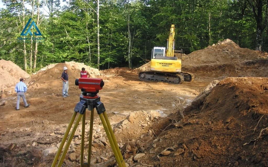
A benchmark is a fixed point of known elevation that crews use as the starting reference for all layout work on a site. Control points are sometimes set using the hub and tack method, where a wooden stake, called a hub, is driven into the ground and a nail, called a tack, marks the exact point. Spreading several control points across a site means no single point becomes a bottleneck if it gets disturbed.
Offset and grade
An offset is a measured distance set away from a building line or control point, often used to keep a stake clear of an area that will later be excavated or poured. Grade refers to the elevation of the ground or a finished surface, and crews are frequently asked to lay out construction reference points to a specific grade, meaning a defined elevation rather than just a flat location.
Elevation reference points
Elevation reference points tell crews how high or low a feature should sit relative to a benchmark, expressed in feet or meters above a known datum. These points matter for everything from setting a foundation at the correct depth to confirming that a slab will be poured level and at the height the design requires.
Total station and GNSS equipment
A total station is a surveying instrument that measures angles and distances electronically, allowing a crew to locate a point with high precision relative to a known control point. GNSS, short for global navigation satellite system, uses satellite signals to establish a position directly in the field, which is useful on larger sites where running a line of sight between control points would otherwise take longer.
Limits of disturbance
Limits of disturbance, often abbreviated LOD, mark the boundary within which construction activity, grading, and equipment movement are permitted. Construction layout typically includes flagging or staking the LOD early in a project to protect surrounding vegetation, wetlands, or adjacent properties and to keep the project compliant with environmental and permitting requirements.
Who performs construction layout
This work is typically carried out by a combination of professionals, depending on the size and complexity of a project. A licensed land surveyor usually establishes the initial control points and legal boundaries before construction begins. From there, a civil engineer may set design-level reference points tied to grading and utility plans.
On the job site itself, layout technicians or members of the general contractor’s field crew use those control points to mark building corners, column lines, and trade-specific layout for framing and for mechanical, electrical, and plumbing systems. On larger commercial projects, each subcontractor is often responsible for laying out its own scope of work, building off the same control points the surveyor and general contractor established earlier.

How the construction layout process works
While the specifics vary by project, most crews lay out construction reference points in a consistent sequence, from site control to finished elevations.
Establishing control points and benchmarks
The process begins with a land surveyor or layout professional setting horizontal and vertical control points across the site, tied to a fixed benchmark. These points become the reference framework that every later layout step, and every trade, will use for the remainder of the project.
Marking building corners and foundation walls
Using the established control points, crews measure out and mark the building’s corners, then use those corner points to lay out the lines that define the layout of the foundation walls. A chalk line, string, or laser is typically used to connect marked points into a continuous reference line that excavation and concrete crews can follow.
Setting column grid lines
On structures with a steel or concrete frame, crews establish a grid of column lines based on the structural drawings. Each column location is measured from the established grid and marked, often with an offset point nearby so the mark is not lost once excavation or formwork begins.
Staking utility trenches and curb lines
Underground utilities, including water, sewer, and electrical lines, are staked along their planned routes so excavation crews dig in the correct location and to the correct depth. On projects involving roads, parking, or sidewalks, curb lines are staked separately to keep paving and drainage aligned with the approved civil plans.
Checking elevations before concrete placement
Before concrete is poured for footings, slabs, or foundation walls, crews check elevations against the design grade using a level, total station, or GNSS receiver. This final elevation check catches errors while they are still inexpensive to correct, well before the concrete sets and the layout becomes permanent.
Modern tools and technology in construction layout
Traditional layout relies on tools that have been used for generations: tape measures, chalk lines, string lines, and optical levels. These remain accurate and practical on smaller projects.
Larger or more complex projects increasingly rely on digital instruments:
- Robotic total station: Operated by a single technician who remotely tracks a prism to set or record points with high precision, without requiring a second crew member to hold the target.
- GNSS receiver: Uses satellite signals to establish a position directly in the field, speeding up layout on large open sites where running traditional sightlines would take considerably longer.
- BIM and CAD-to-field connection: Many instruments now connect directly to a building information model or CAD file, letting crews pull design coordinates from the model rather than re-entering them from a printed drawing.
What happens when construction layout is inaccurate
When layout work is off, even by a small margin, the consequences tend to compound as a project moves forward:
- Wasted or unusable space: A small layout error can leave a room, hallway, or parking area too narrow for its intended use, reducing the functional value of the finished building.
- Project delays: Correcting a layout mistake often means stopping work, remarking points, and waiting for crews and inspections to catch up, which pushes back every milestone that follows.
- Material and labor costs: Materials cut or installed based on an inaccurate layout frequently need to be removed and replaced, adding both material waste and additional labor hours to the budget.
- Coordination conflicts between trades: Structural, mechanical, electrical, and plumbing systems are designed to fit together within tight tolerances, and a layout error in one trade can create conflicts that surface only after another trade has already started its own work.
- Compliance and safety risk: Layout errors that affect limits of disturbance, setbacks, or required clearances can create permitting issues or safety hazards that require correction before a project can move forward.
Conclusion
Construction layout is one of the most consequential steps in any building project, yet it often receives less attention than the visible work that follows it. Every element built on a job site, from the foundation to the finished structure, depends on the accuracy of the reference points established before excavation begins.
Alliance EDS manages residential and commercial construction projects across the Denver, Colorado area from initial planning through completion, working alongside surveyors, engineers, and design teams to keep each project aligned with its approved plans from the first marked point on site. If you have a construction, renovation, or property improvement project in the works and want a contractor who treats the early planning stages with the same care as the finished result, call Alliance EDS at (720) 484-8181 to talk through your project and request a free estimate.
Frequently asked questions (FAQs)
What is a building layout plan?
A building layout plan is the document or drawing that shows where a structure’s walls, columns, and key reference points will sit on a site, based on the approved architectural and engineering design. Field crews use it as the source for marking actual construction layout points on the ground.
What is the difference between construction layout and land surveying?
Land surveying establishes legal property boundaries, topography, and the initial control points for a site, usually performed by a licensed surveyor. This step uses those control points to mark the specific locations needed to build a structure, including corners, columns, and utility lines, and it typically continues throughout the construction phase rather than ending after a single survey visit.
What is building site layout?
Building site layout refers to the overall arrangement of a project on its lot, including the building footprint, parking, access drives, and utility connections, in relation to the property lines. It is typically established early in design and then translated into field layout points once construction begins.
Do I need a professional for construction layout?
Most construction projects benefit from a licensed surveyor or experienced layout professional, particularly for establishing initial control points and any work involving property boundaries or environmental limits of disturbance. Many general contractors also handle trade-specific layout in house once those initial control points are in place.
What is the difference between layout and construction?
Layout is the step that translates a design into accurate, marked reference points on the job site. Construction is the broader process of building the structure itself, using those layout points as a guide. Layout typically happens just ahead of each phase of construction, from initial site work through framing and finishes.